Overview
What is Nonpoint Source Pollution?
Nonpoint source pollution results from rainfall or snowmelt moving over and through the ground. As the runoff moves, it picks up and carries away natural and human-made pollutants, finally depositing them into lakes, rivers, streams, wetlands, and even our underground sources of drinking water. Unlike pollution from direct sources, such as industrial plants, NPS pollution can come from many diffuse sources.
Potential sources of NPS Pollution include:
- Excess fertilizers and chemicals from agricultural lands, residential, and urban areas
- Sediment from improperly managed construction sites, crop and forest lands, and eroding streambanks
- Bacteria and nutrients from livestock and animal wastes
- Hydro-modification
The Arkansas Natural Resources Division (ANRD) is responsible for developing and implementing the state's Non-point Source (NPS) Pollution Management (319) Program. This program is a cooperative effort of many local, state, and federal agencies.
What is the NPS 319 Grant Program?
Section 319(h) of the Clean Water Act provides federal funding through the Environmental Protection Agency to states to reduce and control NPS pollutants. ANRD’s Nonpoint Source Program accepts project proposals to select recipients for 319 grant funding. Projects may include the implementation of Best Management Practices (BMPs), demonstrations of effective techniques, technical assistance, education, and monitoring.
Who is eligible for 319 Grant funding?
Recipients eligible for funding must be non-profit organizations (documented and recognized), state or local government agencies, or academic institutions. Federal agencies are ineligible for 319 grant awards. Recipients must provide a minimum of 40% non-federal match (in-kind or cash).
The NPS program uses its NPS Program Management Plan and the EPA 319 Grant Guidance as part of the criteria for selecting grant recipients.
Priority Watersheds

The 319 funds target priority watersheds with EPA-accepted 9 Element Watershed Management Plans (WMPs). The priority watersheds were designated using a risk assessment matrix process and through nonpoint source stakeholders. The current priority watersheds for 2024-2029 are as follows:
- Bayou Bartholomew
- Beaver Reservoir - Upper White River (WMP in Progress)
- Cadron Creek
- Illinois River (WMP in Progress)
- Lake Conway – Point Remove
- Little Red River
- Lower Little River
- Lower Saline
- Lower White-Bayou Des Arc
- Middle White River
- Quachita Headwaters
- Poteau River

Additionally, funds may be spent in other watersheds with 9 Element WMPs:
- Bayou Bartholomew
- Bayou Meto
- Beaver Lake
- Beaver Reservoir - Upper White River (WMP in Progress)
- Buffalo River
- Cache River
- Frog Bayou
- Illinois River(WMP in Progress)
- Lake Conway – Point Remove
- L’Anguille River
- Lee Creek
- Little Red River
- Lower Arkansas – Maumelle (WMP in progress)
- Lower Little River
- Middle White River
- Poteau River
- Strawberry River
- Upper Saline River (WMP update in progress)
- White Oak Bayou
Nonpoint Source Management Plan
ANRD’s Nonpoint Source Program oversees the development and revision of the 5-year Nonpoint Source Pollution Management Plan. The Plan was created in cooperation with the University of Arkansas System Division of Agriculture’s Public Policy Center and Crop, Soil, and Environment Science staff. Revisions of the 2018-2023 Plan are currently underway.
Why Fund Watershed Projects?
Watershed projects promote understanding of the full range of stressors in a watershed—physical, chemical, and biological—that may be affecting aquatic life and human health. When all significant sources and stressors are understood, the program and subsequent projects are better able to focus on those controls that are more likely to produce measurable improvements in ecosystem health.
Administratively, watershed projects are highly efficient. They encourage local and statewide cooperating entities to focus staff and financial resources on prioritized geographic locations and facilitate coordination of resources among interested parties. Also, they provide local agencies with an opportunity to take leadership roles in ecosystem protection. Individual watershed projects provide a statewide proving ground for innovative approaches as new models are developed and new watershed-level management approaches are tried.
Finally, watershed projects encourage local agencies and citizen groups to get involved either by participating in state or federal projects or by starting their own watershed projects. Projects create a sense of ownership within the project area and engender enthusiasm that will carry forward to new initiatives.
The elements of an effective watershed project are:
• Building a Project Team and Public Support:
Developing effective institutional arrangements and ownership of the project by stakeholders.
• Defining the Problem:
Developing an inventory of the watershed and its problems and conducting baseline monitoring.
• Setting Goals and Identifying Solutions:
Developing project goals, a list of management measures, and a detailed plan for their implementation.
• Implementing Controls:
Obtaining funding, securing commitments, and installing controls.
• Measuring Success and Making Adjustments:
Documenting success in meeting goals, monitoring, changing management measures as needed, and ensuring project continuity.
Related ANRD Programs That Address NPS Pollution:
Arkansas Unpaved Roads Program
Arkansas Nutrient Reduction Strategy
Wetland & Riparian Zones Tax Credit Program
Annual 319 Program Timeline
October/November: ANRD’s NPS Program issues Request for Proposals or workplans
December/January: NPS Program staff work with partners to strengthen workplans
End of January: Completed workplans are due
February: Workplans are sent to EPA for comment
April/May: EPA sends back comments; comments are addressed
July/August: NPS Program prepares sub-grant agreements (contracts) for project partners
September: Sub-grant agreements are signed
Beginning of October: Projects begin
FY25 319(h) Application Materials
The Water Quality Section staff are accepting pre-proposal applications for Federal Fiscal Year 2025 from July 22 through September 13, 2024. If selected to submit a full workplan, applicants will have until January 31, 2025, to submit full workplan proposals. Please submit your pre-proposals and questions to anrc.nonpoint@agriculture.arkansas.gov.
FY25 319 Eligibility Requirements
Title X Water Resource Agricultural Cost-Share Program
Title X Water Resource Agricultural Cost-Share Program – General Information
Purpose
Nonpoint source pollution (NPS) occurs when rainfall or irrigation runs over land or through the ground, picks up pollutants, and deposits them into rivers and streams or introduces them into groundwater. The most common causes of NPS are siltation/turbidity, excess nutrients, bacteria, and chemicals from agriculture, surface erosion, and urban runoff. The Title X Cost-Share Program provides financial assistance to landowners implementing best management practices to reduce NPS.
What is a 319 Nonpoint Source Grant?
Section 319(h) of the Clean Water Act provides federal funding through the Environmental Protection Agency to states to reduce and control NPS pollutants. The Arkansas Department of Agriculture Natural Resources Division’s (NRD) Nonpoint Source Program accepts project proposals to select recipients for 319 grant funding. The Title X Cost-Share Program is a type of 319 grant which works through County Conservation Districts. There is a minimum of 40% non-federal match (in-kind, cash, or landowner participation). The 319 grant will be awarded to the County Conservation District, which will work with landowners interested in financial assistance for best management practices. For more information, please refer to the Overview Tab listed on this page.
What kind of best management practices qualify for Title X program?
Any Natural Resources Conservation Services (NRCS) practice that is documented to reduce nonpoint source pollution. All practices must be approved by NRD before project activities begin to qualify for cost-share. Some of the most popular best management practices include:
- Brush Management
- Cover Crops
- Cross Fencing
- Forage and Biomass Planting
- Heavy Use Area Protection
- Irrigation and Livestock Pipelines
- Prescribed Grazing
- Nutrient Management
- Silvopasture
- Tree/Shrub Establishment
- Watering Facilities
- Riparian Forest Buffer
Irrigation Reservoir - Irrigation System-Tailwater Recovery
- Wetland Creation, Enhancement, Restoration
Are there any restrictions on the kinds of projects eligible for the program?
NRCS specifications are required for each practice to be eligible for reimbursement. The property on which the proposed project is located must have a current conservation plan on file with the County Conservation District. The applicant must own the property on which the project will be completed or rent the property and have owner permission to implement these practices.
Who determines which projects are eligible for this program?
Ultimately, NRD’s Water Quality Section has discretion to approve any proposed project. Also, the applicant’s conservation plan will help determine which best management practices are the most effective for their property.
Who is eligible to receive cost-share for the Title X program?
An applicant may be an individual, partnership, corporation, limited liability company, joint venture, watershed improvement district, drainage district, or regional water distribution district that owns property in a County Conservation District. The County Conservation District must have an open 319 grant with NRD for applications to be accepted.
What is the maximum amount of cost-share I can receive?
There is a 60% federal and 40% landowner match requirement. The applicant cannot exceed the federal $15,000 limit in a three-year period. If an applicant has an open EQIP project at the same time as a Title X cost-share project, they cannot exceed 75% federal portion of total project costs.
Title X Water Resource Agricultural Cost-Share Program – Conservation District
How does an applicant participate in this program and receive cost-share assistance?
The applicant must fill out the application forms and send them to the County Conservation District. The County Conservation District can reach out to NRD staff if there are any questions regarding the application process.
What happens after an applicant submits the project application forms?
The County Conservation District will send the forms for approval by NRD. If approved, the applicant can begin implementation immediately. Once the best management practice is complete, a final inspection is completed by the County Conservation District. The final inspection form is sent to NRD, and the applicant’s reimbursement will be mailed within 60 days.
How long does an applicant have to maintain the project after it’s completed?
All projects or practices constructed or installed under this program shall be properly maintained for the predetermined project life, usually determined by NRCS specifications. Project maintenance shall be the responsibility of the applicant. The County Conservation District and NRD reserve the right to make periodic inspections of the project or practice during the predetermined life of the project or practice.
What does a timeline look like for the Title X program?
- August – September: County Conservation District completes a pre-proposal form and send it to NRD staff.
- October – January: If the pre-proposal is accepted by NRD, the County Conservation District will work with NRD staff to write a 319 grant workplan that will last an approximate 3-year period.
- January: a complete workplan is sent to NRD staff.
- May: All workplans are submitted to EPA for approval.
- May – July: EPA approval notice for workplans.
- August – September: County Conservation District will be notified of workplan acceptance and federal funding.
- October: Project will begin, and landowners can begin the application process
- Applicants will submit application forms.
- Once forms are approved by NRD, landowner can begin implementation.
- After implementation, County Conservation District staff will inspect and complete final inspection form.
- Final inspection form is sent to NRD and the applicant will be reimbursed within 60 days of sending in the form to NRD.
I would like the Title X rules and application forms for the cost-share program.
Click here to download the Title X Rules administering the program. All application forms can be provided upon request.
Title X Water Resource Agricultural Cost-Share Program – Landowners
How does an applicant participate in this program and receive cost-share assistance?
The applicant must fill out the application forms and send them to the County Conservation District. The County Conservation District can reach out to NRD staff if there are any questions regarding the application process.
What happens after an applicant submits the project application forms?
The County Conservation District will send the forms for approval by NRD. If approved, the applicant can begin implementation immediately. Once the best management practice is complete, a final inspection is completed by the County Conservation District. The final inspection form is sent to NRD, and the applicant’s reimbursement will be mailed within 60 days.
How long does an applicant have to maintain the project after it’s completed?
All projects or practices constructed or installed under this program shall be properly maintained for the predetermined project life, usually determined by NRCS specifications. Project maintenance shall be the responsibility of the applicant. The County Conservation District and NRD reserve the right to make periodic inspections of the project or practice during the predetermined life of the project or practice.
What does a timeline look like for the Title X program?
- August – September: County Conservation District completes a pre-proposal form and send it to NRD staff.
- October – January: If the pre-proposal is accepted by NRD, the County Conservation District will work with NRD staff to write a 319 grant workplan that will last an approximate 3-year period.
- January: a complete workplan is sent to NRD staff.
- May: All workplans are submitted to EPA for approval.
- May – July: EPA approval notice for workplans.
- August – September: County Conservation District will be notified of workplan acceptance and federal funding.
- October: Project will begin, and landowners can begin the application process
- Applicants will submit application forms.
- Once forms are approved by NRD, landowner can begin implementation.
- After implementation, County Conservation District staff will inspect and complete final inspection form.
- Final inspection form is sent to NRD and the applicant will be reimbursed within 60 days of sending in the form to NRD.
I would like the Title X rules and application forms for the cost-share program.
Click here to download the Title X Rules administering the program. All application forms can be provided upon request.
For more information contact:
Tate Wentz, Water Quality Section Manager
Arkansas Department of Agriculture
Natural Resources Division
10421 W. Markham Street
Little Rock, Arkansas 72205
Phone: (501) 682-3914 Fax: (501) 682-3991
Email: tate.wentz@agriculture.arkansas.gov
Success Stories
Our Projects
FY 2017 Projects
Upper Cache River Watershed Monitoring
Project #: 17-200
Lead Project Partner: Arkansas State University Ecotoxicology Research Facility
Status: Complete
The Cache River has been identified as a source of excess nutrients that is contributing to the hypoxic zone in the Gulf of Mexico, with agricultural activities in the area thought to be contributing to the problem. The watershed is highly channelized, which makes managing sediment and nutrient input challenging. This project builds on previous monitoring within the Cache River watershed by measuring water quality parameters at the inputs of each of the 12 main tributaries of the mainstem, with 2 sampling sites in the mainstem itself. The results of the project found that agricultural intensity drives the need for Best Management Practices to adequately manage sediment. More “natural” systems in the watershed, such as on Crowley’s Ridge, tended to acquire less pollutants than areas with heavy agricultural use and channelization. A few of the sub-watersheds saw an increase in nonpoint source pollution over the three-year period of the project. This project has helped to understand our water resources in the watershed area, as well as highlighted the need for certain interventions.
Water Quality Monitoring in the Upper Poteau River Watershed
Project #: 17-300
Lead Project Partner: Arkansas Water Resources Center
Status: Complete
The Upper Poteau River Watershed has been an NPS Program priority watershed since the late 1990’s. Over the years, targeted management has resulted in the reduction of pollutants, but there is still work to be done. ANRD has funded several 319(h) projects in the
area, including ones involving monitoring, BMP implementation, and education. The purpose of this project is to measure just how much these measures have impacted the watershed. Data was collected across the watershed at 15 sites (3 near existing USGS flow gauges and 12 at the outflow of each HUC-12 sub-watershed) for a period of 3 years. Results indicated that urban and agricultural land use increases predicted increases in some water quality parameters, such as total nitrogen, total phosphorus, and total dissolved solids, but not in others, such as turbidity and sulfate. Concentrations of constituents tended to be greatest during the summer months and least in the spring but were variable across sites and seasons. The Lower Poteau River site, which was downstream from Waldron’s wastewater treatment plant and has a watershed with 33% agricultural land use, saw the highest magnitude of constituent loads. Some data from the sites near USGS gauges indicated that where water quality is improving, it is improving faster than where water quality is decreasing. The results of the project highlighted the value and need for water quality data in understanding pollutants and long-term trends in small-scale sub-watersheds.
Water Quality Monitoring for the Bayou Bartholomew Watershed
Project #: 17-400
Lead Project Partner: Equilibrium Inc.
Status: Complete
Bayou Bartholomew Watershed, with the main channel beginning northwest of Pine Bluff and flowing into Louisiana, is listed as impaired on ADEQ’s 303(d) List. Monitoring projects help identify issues and trends in watersheds. The goal of this monitoring project was to collect and analyze water quality and discharge data across the watershed, especially in HUC-12 sub-watersheds, across a four-year period. Only 11 out of 90 trend analyses for contaminant concentration resulted in statistically significant trends. At a few sampling sites, turbidity has been decreasing over time, with sulfate concentrations shown to be decreasing at one of those sites, as well. Additionally, parameter loadings were summed at each sampling station, most of which increased as water moved downstream from station to station, especially in the Cousart Bayou and Deep Bayou sub-watersheds.
Lake Conway-Point Remove Watershed Monitoring and Assessment
Project #: 17-500
Lead Project Partner: Lake Conway-Point Remove Watershed Alliance
Status: Complete
Primarily an Arkansas River Valley watershed, the Lake Conway-Point Remove (LCPR) Watershed is somewhat anomalous in that it does not have a mainstem. Instead, several stream systems ultimately flow into the Arkansas River. There are several streams within the watershed that are also impaired due to excessive levels of metals and nutrients. Monitoring projects have been ongoing in the watershed in previous years, like Project #11-600 and 15-300, completed by Equilibrium Inc. While these projects have been instrumental in understanding baseflow water quality within the watershed, there was not enough data to develop a comprehensive watershed management plan. This project aimed to fill in the gaps. Data was collected and analyzed by GBM & Associates, University of Central Arkansas, and the Arkansas Water Resource Laboratory. Results showed striking differences between pollutant levels during storm flow events versus baseflow events. Potential NPS sources were identified by thoroughly assessing land use types in each sub-watershed, for example calculating the number of chicken houses in the area. The water quality data combined with the land use data is a valuable tool for prioritizing sub-watersheds in a 9-Element Watershed Based Plan.
Ecological Evaluation of Priority Sub-watersheds in the Illinois River Watershed
Project #: 17-600
Lead Project Partner: Illinois River Watershed Partnership (IRWP)
Status: Complete
Due to constraints such as funding and personnel, monitoring in the Illinois River Watershed is usually limited to downstream water quality monitoring, which misses important information about habitat and biological parameters. This project aimed at two birds with one stone: educate local students about local water resources and aquatic habitats, while collecting baseline data for long-term monitoring at four priority sub-watersheds, including Moore’s Creek, Sager Creek, Lower Muddy Fork, and Clear Creek.
IRWP worked with local EAST students to conduct GIS assessments of each sub-watershed, who were then trained in the field to conduct biological and ecological evaluations by Arkansas Game and Fish’s Stream Team Program. The team discovered Clear Creek and Sager Creek were over 40% and 30% urbanized, respectively, while Muddy Creek and Moore’s Creek had hardly any urbanized land, mostly being forested or pastured. However, it is important to note data used to calculate land use was from 2011, and because of rapid urban growth in the area, the percentages are in reality probably higher. The team also concluded, that based on data gathered for this project, land use does not appear to have an influence on macroinvertebrate diversity. This could indicate that macroinvertebrate diversity is mostly impacted by the immediate habitat within the stream, rather than surrounding areas. IRWP intends to continue this study both in Arkansas and in Oklahoma and share their information with other conservation organizations.
Lower St. Francis River Watershed Cost-Share Project
Project #: 17-700
Lead Project Partner: St. Francis County Conservation District
Status: Complete
Agricultural activity in the Lower St. Francis Watershed led to impairments of turbidity and chloride in Reach 005 of the mainstem in the 2012 303(d) List. Traditional tillage methods on row crops can result in huge amounts of sediment being deposited in waterways, which ultimately lead to the mainstem. The purpose of this project was to educate producers on best management practices (BMPs) and provide cost-share funding to implement said BMPs to minimize sediment lost from the fields. The project was advertised in local news media, newsletters, and public meetings. Interested landowners submitted applications to the Conservation District and were then provided with resources such as funding and technical assistance in implementing BMPs that worked best for the individual landowner. The most popular BMPs selected by landowners were cover crop, mulch till, irrigation water conveyance, and drop pipes. The project took place over a three-year period and the Conservation District plans to continue to conduct similar projects in the future.
Poteau River Sub-Watershed Project
Project #: 17-800
Lead Project Partner: Poteau River Conservation District
Status: Complete
Excessive turbidity and total suspended solids are major concerns in the Poteau River Watershed. Such impairments can be attributed to over application of fertilizer and poultry litter, as well as unrestricted cattle access to tributaries. This project provided Scott County farmers resources needed to implement best management practices (BMPs) in order to protect local water resources. 319(h) funding allowed for the installation of nearly 14,600 feet of fencing to keep livestock out of streams and riparian areas, four 500-gallon tire tanks to provide alternate water sources for cattle, and 850 acres of brush management to improve forage and nutrient use in pastureland. Over 200 farms were funded or given technical assistance to implement BMPs! Farmers were eager to participate in the program and glad to receive assistance in a timely manner.
West Fork Stream Restoration at Brentwood Mountain
Project #: 17-900
Lead Project Partner: Watershed Conservation Resource Center (WCRC)
Status: Complete
The West Fork of the White River is one of the largest contributors of sediment and nutrients to the Beaver Lake Watershed, a priority HUC-8 in the NPS Management Plan. The WCRC, along with partners Beaver Watershed Alliance and Beaver Water District, has designed and implemented a channel design restoration at two priority sites on private land in the West Fork sub-watershed, complete with vegetation establishment to aid in streambank stability and quality habitat. Sediment and phosphorus loadings from each site were estimated to be 1,000 tons per year and 500 pounds per year, respectively. The WCRC has worked extensively on the past to restore the West Fork sub-watershed, effectively restoring 12,000 feet of streams, 24,000 feet of riparian zones, and 5 acres of wetlands. Their work has reduced contaminant loadings by an estimated 8,000 tons of sediment and 3,600 pounds of phosphorous per year. With record flooding and rain events increasing, these load reductions have been invaluable to the health of the watershed and all who live there.
Green Infrastructure in Beaver Lake Watershed
Project #: 17-1000
Lead Project Partner: Beaver Watershed Alliance
Status: Complete
Parts of the Beaver Lake Watershed are impaired due to excessive turbidity and sedimentation. Green infrastructure is a valuable tool that can help mitigate these water quality impairments. The purpose of this project was two-fold: to demonstrate green infrastructure/low impact development techniques in highly visible areas to encourage their use elsewhere and to reduce nonpoint source pollutants from urban runoff in the watershed. Three (3) green infrastructure parking lots were installed at Hickory Creek in Lowell, Mitchusson Park in Huntsville, and Mount Kessler Regional Park in Fayetteville. The lots featured pervious paving, use of native plants, and of course, educational signage. Through this project, Beaver Watershed Alliance was able to reach just less than 3,000 stakeholders through various training and outreach events.
White River Watershed Monitoring Project
Project #: 17-1200
Lead Project Partner: Arkansas State University Ecotoxicology Research Facility
Status: Complete
The objective of this project was to obtain baseline water quality data needed for future watershed-based plan development and possible entry into watershed models in the North Fork White River Watershed, Middle White River Watershed, and the Bull Shoals Watershed (HUC #11010006). Monitoring in the White River Watershed Basin took place in the major tributaries of the North Fork White River Watershed (HUC# 11010006), Middle White River Watershed (HUC# 11010004) and the Bull Shoals Watershed (HUC# 11010003). All three watersheds lie within the White River Basin in Northern Arkansas.
Calhoun County Unpaved Roads Program Support
Project #: 17-1300
Lead Project Partner: Calhoun County
Status: Complete
Unpaved roads are one of the largest contributors of nonpoint source pollution to Arkansas' waterways. Calhoun County recognized a need to implement BMPs on a county road in Locust Bayou township that often flooded and washed out. Calhoun County had originally applied for Arkansas Unpaved Roads support, but due to limited funding available, was able to obtain 319(h) funding instead. The funding provided means for elevating the road, installing a triple box culvert, and adding fabric and rip rap to stabilize slopes. These BMPs will not only reduce sediment runoff but reduce future maintenance costs as well.
FY 2021 Projects
Update of the Watershed Stewardship Program in Arkansas: Phase II
Project #: 21-200
Lead Project Partner: Jefferson County Cooperative Extension Service
Status: Active
The Arkansas Watershed Steward Program was created as a 319(h) project in 2013 (Project #12-500). The need for the Program arose from the need to foster awareness, education, and responsible stewardship of Arkansas’ most important resources. The initial project culminated in the Arkansas Watershed Stewardship Handbook, created by the Extension Service in cooperation with over a dozen partners. Several educational events and meetings were also held. Water quality impairments across the state show a need for adequate stewardship from everyday landowners, especially in areas without active watershed groups. Project #19-1200 sought to grow the Program, first through strategic planning by a steering committee and updating the Handbook. Phase II (Project #21-200) is building on Phase I by creating online Arkansas Watershed Steward training modules, complete with recorded presentations, a discussion board, and quizzes. A curriculum development committee will be formed to develop the content, as well as continue to update the Handbook and previously developed PowerPoint slides. For more information, go to https://www.uaex.uada.edu/environment-nature/water/ar-watershed-stewardship.aspx.
Lower Ouachita-Smackover Watershed Management Plan
Project #: 21-300
Lead Project Partner: Southwest Arkansas Planning and Development District
Status: Active
Dominated by forest used for silviculture and wetlands, the Lower Ouachita-Smackover Watershed is located entirely in the Gulf Coast Plain. Five streams and rivers within the 8-digit HUC are on ADEQ’s 2018 303(d) List for levels of metals, nutrients, turbidity, dissolved oxygen, and pH, depending on the stream. This project will examine past monitoring data, identify sources of the pollutants, and conduct surveys. A SWAT model for the watershed will be generated with up-to-date data, and using information from this model, an EPA 9 Element Plan for the watershed will be developed. Additionally, the project aims to engage and educate the community and stakeholders about water resources and BMPs.
Lower Arkansas-Maumelle Monitoring and Assessment
Project #: 21-400
Lead Project Partner: Audubon Arkansas
Status: Active
In cooperation with the City of Little Rock, Friends of Fourche Creek, CAW, UALR, ADEQ, and the City of Maumelle, Audubon Arkansas will collect data on the Lower Arkansas-Maumelle HUC-8 Watershed. This project will represent Phase I of II of a larger effort to develop a SWAT model and EPA 9-Element Watershed Management Plan for the watershed. The watershed drains into the Arkansas River and encompasses most of Pulaski County and portions of Saline, Perry, and Jefferson Counties. The two HUC-12 sub-watersheds of interest are Fourche Creek and the Maumelle River, which feeds into Lake Maumelle. Fourche Creek, dominated by urban land use, is listed on ADEQ’s 2018 303(d) List for metals, fecal coliform, sediment, and dissolved oxygen. Other significant land uses within the watershed are agriculture (row crops) and forest. Monitoring and assessment of the watershed will inform watershed management decision-making and help better identify problems.
Jones Fork/Winfrey Valley Stream Bank Stabilization
Project #: 21-500
Lead Project Partner: Crawford County Road Development
Status: Active
Part of the greater Upper Frog Bayou Watershed, banks Jones Fork Creek has contributed over 20,000 cubic feet of sediment into the waterbody over the last 5 years. Along with the City of Fort Smith, Crawford County Road Department will re-slope, stabilize, and re-vegetate nearly 700 feet of eroding stream bank.
South Fork Spring River Sub-Watershed Cost Share
Project #: 21-600
Lead Project Partner: Fulton County Conservation District
Status: Active
A sub-watershed of the Spring River Watershed Basin, the South Fork Spring River and its tributaries flow through the Ozark Highlands of Fulton County. The South Fork provides quality recreational opportunity year-round, but is being affected by over-grazing, unrestricted cattle stream access, and stream bank erosion. The high number of cattle and dairy farms in the area highlights the great potential of implemented BMPs to enhance and protect water quality. The Fulton County Conservation District plans to implement BMPs and provide technical and financial assistance to farmers within the watershed.
Buffalo River Tributary Cost Share
Project #: 21-700
Lead Project Partner: Buffalo Conservation District (Searcy County)
Status: Active
Part of the White River Basin, the Buffalo River Watershed spans ten counties. The Buffalo National River draws approximately $55 million annually to the region, including Searcy County. Other waterbodies including Calf, Bear, Tomahawk, Brush, and Lower Big Creeks are all part of the watershed in Searcy County. However, several portions of the Buffalo River in Searcy County have been identified as impacted on ADEQ’s 2018 303(d) List due to total dissolved solids. While the source of the impact on water quality is unknown, nonpoint source pollutants from both urban and rural portions of the watershed are thought to be the cause. This project will encourage landowners to implement BMPs on their properties, such as cattle exclusion fencing, alternate cattle water sources and restoring riparian buffers. The Buffalo Conservation District will also encourage cattle operators to utilize a nutritional monitoring tool designed for free-grazing managers to assist with nutrition and grazing management. The Buffalo Conservation District will provide technical and financial assistance to participating landowners.
Abandoned/Outdated Agricultural Pesticide Collection and Disposal Project
Project #: 21-800
Lead Project Partner: Arkansas Department of Agriculture
Status: Complete
Unknown quantities of unused and outdated pesticides are stored on farms across Arkansas. These pesticides pose a direct threat to both ground and surface waters, especially in light of increasing frequency and intensity of rain events. Since 2005, the Department of Agriculture’s Abandoned Agricultural Pesticide Disposal Program has collected over 5 million pounds of unwanted pesticides. This project collected over 39,000 pounds of unwanted pesticides across 12 counties, including those in 2 priority watersheds.
Poison Springs Complex Road Infrastructure Stabilization
Project #: 21-900
Lead Project Partner: Arkansas Forestry Division
Status: Active
The Poison Springs Complex is contained within three different 8-digit HUCs: the Little Missouri, Upper Ouachita, and Lower Ouachita-Smackover Watersheds. The Lower Ouachita-Smackover Watershed is a priority watershed in the 2018-2023 NPS Management Plan. Sedimentation of the Mill Creek arm of Lower White Oak Lake has been a concern for managers. Though the Nature Conservancy and others have conducted thorough unpaved road assessments across the state, little assessment has been done on roads within the Poison Springs Complex. This project, led by the Department of Agriculture Forestry Division, will conduct an unpaved roads assessment in the Mill Creek Watershed and implement road improvements and BMPs. The goal of the project is to reduce sedimentation due to unpaved roads, the second leading cause of sedimentation in the state.
Lower Ouachita-Smackover Water Quality Monitoring
Project #: 21-1000
Lead Project Partner: Equilibrium
Status: Active
Primarily rural and forested, the Lower Ouachita-Smackover Watershed has 21 segments listed in ADEQ’s 2018 303(d) List of Impaired Waterbodies. Contaminants include chloride, copper, lead, mercury, nitrates, sulfates, and total dissolved solids, with inadequate levels of pH, dissolved oxygen, and turbidity. The sources of pollution are unknown. The watershed is also considered a priority watershed in the 2018-2023 NPS Pollution Management plan, which calls for strategic water monitoring of the watershed. From October 2021 to December 2025, Equilibrium will monitor various parameters of water quality in 10 sub-watersheds (12-digit HUCs), including but not limited to Mill Creek-Smackover Creek, Sloan Creek, Gum Creek, Black Lake, and Dry Branch-Champagnolle Creek. Monitoring provides crucial information to natural resource managers in identifying problems and trends. This information is necessary to implement solutions to problems and protect our water resources.
Arkansas Silviculture BMPs Outreach Project
Project #: 21-1100
Lead Project Partner: Arkansas Forestry Division
Status: Active
Considered priority watersheds in the 2018-2023 NPS Management Plan, the Lower Ouachita-Smackover, Lower Little, and Upper Saline Watersheds are located in an area with many timber-harvest operations. Silviculture has been identified as a source of impact (though not impairment) to water quality and is most commonly associated with sedimentation. With this project, the Forestry Division will work with landowners and partners such as the Arkansas Forestry Association and the Arkansas Timber Producers Association to conduct educational trainings on silviculture BMPs. The Forestry Division also aims to contract with consultants to develop Forest Stewardship Management Plans for landowners within the project area. The goal of the project is to increase landowners’ awareness and practice of BMPs and therefore reduce nonpoint source pollution.
North Fork White River Watershed Monitoring
Project #: 21-1200
Lead Project Partner: Arkansas State University
Status: Active
According to ADEQ’s 303(d) List, several major tributaries of the North Fork White River Watershed are not adequate for supporting aquatic life or primary contact. Impairments in the watershed include total dissolved solids, nitrate levels, and low dissolved oxygen. ASU’s Ecotoxicology Research Facility will monitor for multiple water quality parameters in 6 sub-watersheds (12-digit HUCs) including Outlet Big Creek, Outlet Big Creek tributary, South Brushy Creek-Norfolk Lake, Outlet Bennetts River, Little Creek, and Bennetts Bayou. Water quality data will illuminate problems and trends and will be used in a watershed modeling project.
Eleven Point River Watershed Monitoring
Project #: 21-1300
Lead Project Partner: Arkansas State University
Status: Active
Thirty-three miles of the Eleven Point River is classified as impaired due to low dissolved oxygen and therefore not supportive of aquatic life, according to ADEQ’s 303(d) List of Impaired Waterbodies. Agricultural activities in the area have been identified as the source of pollution. ASU will monitor for multiple water quality parameters in four sub-watersheds (12-digit HUCs), including Dry Creek, Eassis Creek, Thompson Creek, and Hubble Creek. Again, this monitoring data is valuable in providing insight into water quality problems and trends and will lend itself to implementing solutions and protecting water resources.
FY 2018 Projects
*Fiscal Year 2018 served as an administrative year, meaning NRD did not issue a Request for Proposals (RFP). As the program does not receive any state funding, the NPS Program utilizes every fifth year of 319(h)(h) funding to fund the administrative capacity of the program. Additionally, this allows us to finalize projects and update the NPS Management Plan as we near the end of our 5-year cycle.
2021 Semi-annual Nonpoint Source Conference for Arkansas
Project #: 18-101
Lead Project Partner: FTN Associates
Status: Complete
Planning, promotion, and hosting of the Semi-annual NPS Stakeholder Conference in June 2022.
Update of Nonpoint Source Pollution Watershed Risk Matrix
Project #: 18-102
Lead Project Partner: FTN Associates
Status: Complete
This project has resulted in an update the NRD risk matrix with the most recent datasets and utilize the updated risk matrix to prioritize HUC-8 watersheds in Arkansas.
Upper Illinois River Watershed Management Plan
Project #: 18-103
Lead Project Partner: FTN Associates
Status: Active
Soil and Water Assessment Tool (SWAT) analysis allows for ranking of sub-watersheds based on sediment and nutrient loads. This will allow the 9-Element WBP for the watershed to be updated.
SWAT Model for the Upper White River Watershed
Project #: 18-104
Lead Project Partner: H2Ozarks (formerly known as Ozarks Water Watch)
Status: Active
Soil and Water Assessment Tool (SWAT) analysis allows for ranking of sub-watersheds based on sediment and nutrient loads. This project will be followed by a 9-Element WBP for the Upper White River Watershed.
Update of Nonpoint Source Pollution Management Plan for 2023-2028
Project #: 18-105
Lead Project Partner: FTN Associates
Status: Active
The NPS Pollution Management Plan serves as a statewide reference to assist programs that aim to improve water quality and effectively steward Arkansas’ water. The Plan is updated every 5 years under direction of NRD, who has contracted with FTN to complete the project. Statewide stakeholder input is an invaluable part of the planning process, as well.
FY 2019 Projects
Buffalo River Conservation Committee Unpaved Roads: Cave Mountain Road
Project #: 19-201
Lead Project Partner: Newton County Road Department
Status: Active
Primarily an Arkansas Unpaved Roads Program (AURP) project with supplemental 319(h) NPS funding, the Cave Mountain Road project aims to reduce sediment in the Buffalo River Watershed. Unpaved roads are the second leading cause of nonpoint source pollution in the state, including sediment, which is the largest pollutant by volume in Arkansas. By incorporating Best Management Practices (BMPs) and Environmentally Sensitive Maintenance (ESM) on unpaved roads, sediment in waterways can be reduced. This project will include the installation of cross pipes and guard rails, as well as the enhancement of the base roadway with clay, crushed stone, chip-and-seal, and roller compaction.
Buffalo River Conservation Committee Unpaved Roads: Cane Branch Road Project
Project #: 19-202
Lead Project Partner: Searcy County
Status: Complete
Like Project 19-201, the Cane Branch Road Project is primarily an Arkansas Unpaved Roads Program (AURP) project with supplemental 319(h) NPS funding. The project aimed to reduce sediment in the Buffalo River Watershed. Unpaved roads are the second leading cause of nonpoint source pollution in the state, including sediment, which is the largest pollutant by volume in Arkansas. By incorporating Best Management Practices (BMPs) and Environmentally Sensitive Maintenance (ESM) on unpaved roads, sediment in waterways can be reduced. BMPs implemented included the installation of 21 cross pipe culverts, grade breaks, and road grading and ditch re-shaping. This project passed final inspection in October 2021.
Buffalo River Watershed Monitoring
Project #: 19-300
Lead Project Partner: Arkansas State University Ecotoxicology Research Facility
Status: Complete
Named the first National River in the US and designated as an Extraordinary Resource Waterway by ADEQ in 2008, the Buffalo River offers year-round recreation opportunity, supports local economies through tourism, and provides quality habitat for wildlife. However, parts of the watershed have been impaired due to TDS, dissolved oxygen, and temperature. The ASU Ecotoxicology Research Facility is monitoring multiple physical and chemical water quality parameters in eight sites across four sub-watersheds (12-digit HUCs). The four monitored sub-watersheds are Calf Creek, Brush Creek, Tomahawk Creek, and Bears Outlet Creek.
Middle White River Watershed Monitoring
Project #: 19-400
Lead Project Partner: Arkansas State University Ecotoxicology Research Facility
Status: Complete
The Middle White River spans multiple ecoregions, transitioning from the Ozark Highlands down to the Delta. The watershed sees transitional land uses, as well, moving from majority pastureland to row crop agriculture. ASU’s Ecotoxicology Research Facility is monitoring four sub-watersheds (12-digit HUCs) in this transitional zone of the Middle White Watershed, including Greenbriar Creek, Spring/Sprint Creek, Lower Salado Creek, and Miller Creek.
Bayou DeView Watershed Monitoring
Project #: 19-500
Lead Project Partner: Arkansas State University Ecotoxicology Research Facility
Status: Complete
In order to measure effectiveness of BMPs associated with the Mississippi River Basin Initiative (MRBI) and other water quality programs, ASU’s Ecotoxicology Research Facility is monitoring several physical and chemical water quality parameters in Bayou DeView. The MRBI project has identified the nutrients and suspended solids in the Cache River Watershed as contributing factors to the Gulf of Mexico hypoxia zone. Bayou DeView, a tributary to the Cache River, has been noted to contribute contaminants.
Crooked Creek Cost-Share
Project #: 19-600
Lead Project Partner: Boone County Conservation District
Status: Complete
Crooked Creek, a part of Bull Shoals Lake Watershed in Northwest Arkansas, is a popular destination for floating and smallmouth bass fishing. However, portions of the creek have been identified as impaired due to total dissolved solids levels. The source of the pollution is unknown but thought to originate from both urban and rural sources, such as poultry and livestock operations. Reduction of vegetated stream banks is also a likely contributing factor. Boone County Conservation District’s project’s primary objective was to implement a program that will encourage voluntary participation of landowners to implement BMPs on properties within the sub-watersheds adjacent to or contributing to Crooked Creek. BMPs were ultimately established on 2,000 acres and 30 Farm Plans written. Outreach activities such as mailing fact sheets and newsletters reached nearly 300 people.
Markham Square Water Quality Demonstration Project
Project #: 19-700
Lead Project Partner: City of Conway
Status: Complete
Markham Square is located near downtown Conway, one of Arkansas’ fastest growing cities. The overarching goal of the project was mitigation of water quality issues in the Little Creek-Palarm Creek sub-watershed, which is part of the greater Lake Conway-Point Remove Watershed, a priority 8-digit HUC identified in the 2018-2023 ANRD NPS Management Plan. The project aims to transform a former brownfield site into an aesthetically pleasing town square that both benefits water quality, celebrates community, and demonstrates how Low Impact Development (LID) and Green Infrastructure (GI) techniques can be used in sustainable stormwater mitigation and filtration. Project partners have produced several videos about the project, which are available on the City of Conway’s YouTube channel. The park officially opened in July of 2022 as Martin Luther King Jr. Square.
Illinois River Watershed Unpaved Roads BMP Demonstration
Project #: 19-800
Lead Project Partner: Illinois River Watershed Partnership
Status: Complete
The Illinois River Watershed is characterized by rapidly increasing population growth and development in Northwest Arkansas. Several segments of the watershed have surpassed the threshold for acceptable levels of turbidity and sediment. IRWP’s project aims to reduce this sediment by implementing unpaved road BMPs, as well as demonstrations for educational purposes. Two sites in Benton County were selected for the installation of BMPs, including raising of the road profile, broad based dips, and open-bottomed box culverts. IRWP also hosted one of the semi-annual Ecologically Sensitive Maintenance trainings for entities to be eligible for Arkansas Unpaved Road Program funding. There were 31 people in attendance, representing road department and county staff and elected county officials from 11 counties/municipalities.
Lake Conway-Point Remove Water Quality Monitoring
Project #: 19-900
Lead Project Partner: Equilibrium
Status: Complete
Spanning seven counties including Conway, Faulkner, Perry, Pope, Pulaski, Van Buren, and Yell Counties, the Lake Conway-Point Remove Watershed includes several streams listed as impaired on ADEQ’s 2016 303(d) List. Categories of impairments vary, ranging from pH to dissolved oxygen to ammonia-nitrogen to turbidity. The 2018-2023 NPS Management Plan calls for strategic monitoring in priority watersheds, as monitoring increases awareness and understanding of watershed health, and therefore results in higher protection of water resources. The monitoring project collected, analyzed, and reported water quality and discharge data within seven streams at ten sites.
North Fork of White River Sub-Watershed Cost-Share
Project #: 19-1000
Lead Project Partner: Fulton County Conservation District
Status: Complete
The North Fork White is a sub-watershed of the greater White River Watershed Basin and is located primarily in North Central Arkansas. There has been a lack of water quality monitoring in this watershed, but there are visibly high levels of turbidity and sediment load. Land use and more extreme rain events are thought to be contributors. The Fulton County Conservation District project provided technical and cost-share assistance to landowners in implementing BMPs, such as brush management, fencing, heavy use area protection, watering facilities, and more. A sediment trap was also installed to measure sedimentation after rainfall events and to be used as a demonstration project.
Water Quality Monitoring in the Upper Illinois River Watershed and Upper White River Basin
Project #: 19-1100
Lead Project Partner: Arkansas Water Resources Center
Status: Complete
The Upper Illinois River Watershed and the Upper White River Basin (otherwise known as the Beaver Reservoir Watershed) have seen significant land use changes over the past decade as Northwest Arkansas continues to grow. Main tributaries and several reaches of the Illinois River have been listed on the 303(d) list of impaired waterbodies due to nutrients, sediment, and pathogens from urban runoff and other unknown sources. The Upper White Basin, which provides drinking water to most of Northwest Arkansas as well as recreational and aesthetic value to the area, has likewise been impacted by sediment, nutrients, sulfate, and dissolved solids from surface erosion and other unknown sources. Arkansas Water Resources Center combining data from past and current projects to perform trend analyses. Among the results, they found that phosphorus concentrations appear to have decreased over the past 15 years. Several sampling areas also saw overall decreases in nitrogen concentrations, although widespread change throughout the watersheds studied were not observed. However, some water quality degradation was indicated, as well, such as chloride concentrations in urban areas.
Update of the Watershed Stewardship Program: Phase I
Project #: 19-1200
Lead Project Partner: Jefferson County Cooperative Extension Service
Status: Complete
The Arkansas Watershed Steward Program was created as a 319(h) project in 2013 (Project #12-500). The need for the Program arose from the need to foster awareness, education, and responsible stewardship of Arkansas’ most important resources. The initial project culminated in the Arkansas Watershed Stewardship Handbook, created by the Extension Service in cooperation with over a dozen partners. A number of educational events and meetings also took place. Water quality impairments across the state show a need for adequate stewardship from everyday landowners, especially in areas without active watershed groups. Project 19-200 sought to grow the Program, first through strategic planning by a steering committee and updating the Handbook. Phase II (Project #21-200) is underway, as curriculum and online education opportunities are developed. Visit https://www.uaex.uada.edu/environment-nature/water/ar-watershed-stewardship.aspx for more information.
Expanding Green Infrastructure to Southeast Arkansas
Project #: 19-1300
Lead Project Partner: Jefferson County Cooperative Extension Service
Status: Complete
Within the Bayou Bartholomew Watershed in Southeast Arkansas, 29% of households are below the poverty line. The population is 56% Black and 40% White, with people of Latin American and Asian descent present, as well. In the City of Pine Bluff, where much of this project took place, the median income is $30,000, with over 32% of households below the poverty line and 100% of school-age children qualifying for free school lunch. The area is also home to elderly, houseless, and veteran communities, as well. Multiple segments of the watershed listed as impaired, and the area is subject to flooding and sewer overflows, as the area’s infrastructure ages. These problems can have a disproportionate impact on already vulnerable communities in the watershed area. Additionally, water pollutants in the watershed eventually flow to the Gulf of Mexico, where excess nutrients have led to a “dead zone” devoid of aquatic life. While not a magic fix-all solution, green infrastructure is a technique that can help abate these water quality issues and improve the lives of everyone living in the watershed. Project #19-300 led to the installation of ten demonstration projects, including the creation of rain gardens and bioswales. Five green infrastructure elements were installed in Pine Bluff, two in Star City, two at the Lincoln County Extension Office, and one at Cane Creek State Park. The Project also included educational webinars to inform the public and other stakeholders about the benefits of green infrastructure.
NPS Prevention Thru Outreach and Digital Media
Project #: 19-1400
Lead Project Partner: Washington County Cooperative Extension Service
Status: Complete
Northwest Arkansas has experienced tremendous urban growth. From 2000-2010 alone, urban land use increased 72% (from 108 to 187 square miles) accompanying a 71% increase in population. The pace of growth in the region is increasing impervious surfaces and altering land use once largely dominated by forest and pasture. Specifically, the pressure of encroaching urban spaces into rural lands presents significant environmental challenges. Existing and reduced green spaces and rural lands can no longer offset this rapidly changing landscape and its impacts on water quality. The goals of this project were to develop new video podcasts, conduct stakeholder outreach, provide technical assistance on BMP installation, and demonstrate successful LID/BMP techniques to increase nonpoint source pollution awareness within the Illinois River and Beaver Lake Watersheds. Strong partnerships and cooperating agencies made the project successful. The public interest and the visible nature of these water quality demonstrations have been an innovative tool to engage urban stakeholders regarding land-use impacts on water quality of receiving streams. Strong social media response, local media interest, increased volunteer engagement, and expansion of relationships with partners and local businesses increased the visibility of NPS pollution prevention in urban Northwest Arkansas.
FY 2020 Projects
Bull Shoals/White River Watershed Cost Share
Project #: 20-300
Lead Project Partner: Baxter County Conservation District
Status: Active
The primary objective of the project is to maintain or restore all designated uses of Bull Shoals Lake/White River Watershed. Strategies to achieve this include creating a program to encourage voluntary application of BMPs by landowners/users, implementing 200 conservation plans on 38,848 acres of pastureland, and protecting 5 miles of stream bank. According to ADEQ’s 2016 303(d) List, the reach from Bull Shoals Dam to Bruce Creek is impaired due to insufficient levels of dissolved oxygen. While the issue is attributed to the dam, the Baxter County Conservation District has chosen to take a proactive approach by increasing riparian buffer to decrease temperature and therefore, hopefully, increase dissolved oxygen. Additionally, the District wishes to protect other streams from becoming impaired. Bank erosion and agricultural runoff are pressing concerns in the area when it comes to maintaining water quality. The District also plans on building and maintaining publicly visible rain gardens for water quality management and educational purposes.
Buffalo River Watershed Cost Share
Project #: 20-400
Lead Project Partner: Crooked Creek Conservation District (Marion County)
Status: Active
Similar to the Bull Shoals project led by Baxter County Conservation District described above, the Buffalo River Watershed Cost Share project aims to maintain or restore all designated uses of the watershed. Their strategy includes implementing a voluntary BMP program for landowners and implementing 200 conservation plans on 61,000 acres of pastureland, protecting 7.25 miles of stream bank, and installing rain gardens for water quality management and educational purposes.
Lake Atalanta LID Demonstration Project
Project #: 20-500
Lead Project Partner: Beaver Watershed Alliance
Status: Complete
The goal of this project is to promote and make visible Low Impact Development and Green Infrastructure techniques in Northwest Arkansas through a demonstration project installed at Lake Atalanta in east Rogers, upstream of Beaver Lake in the Bear Creek sub-watershed. A past 319(h)(h) project (#15-500) conducted by the City of Rogers and Ozarks Water Watch led to the installment of pervious parking at Lake Atalanta Park. Since the completion of Project #15-500, monitoring data has shown a decrease in total phosphorous in the lake. Project #20-500 expanded LID/GI techniques in the park, such as the installation of permeable pavers, with an emphasis on education via workshops and self-guided tours.
J. Pense Stream Bank Stabilization Project
Project #: 20-600
Lead Project Partner: City of Fort Smith
Status: Complete
Over the past decade, the banks of Jones Fork Creek have drastically eroded. The stream, located in the Upper Frog Bayou Watershed in the Boston Mountains of Crawford County, has vertically eroded the banks to a 14-foot drop, which has contributed approximately 21,500 cubic feet of sediment per year into the waterbody. The City of Fort Smith installed Bendway weirs and longitudinal stone to protection devices and re-sloping approximately 600 feet of streambank to curb the problem. Thirty-foot-deep vegetated riparian zones to maintain the banks are being established.
Northwest Arkansas Low Impact Development 2020 Conference
Project #: 20-700
Lead Project Partner: Illinois River Watershed Partnership
Status: Complete
To promote awareness about stormwater runoff and its impact on water quality, IRWP held a 2-day regional event in November 2021 to educate audiences about techniques and benefits of Low Impact Development (LID). The theme of the event was “In 10 years, what will we wish we had done to protect the watershed?” The conference comprised of guest lectures from a range of speakers, from engineers to land stewards, as well as field tours to see LID in action. You can watch the presentations on the Illinois River Watershed Partnership YouTube Channel.
Restoring Aquatic Connectivity and Reducing Sedimentation in the Upper Saline
Project #: 20-900
Lead Project Partner: The Nature Conservancy
Status: Active
When a culvert’s capacity is exceeded due to heavy rain or flood events, the integrity of the infrastructure may fail and pose a threat to public safety. Increased water velocity and sedimentation also pose a threat to the aquatic life that dwells in the waterbody. TNC has identified several priority stream crossings with problematic culverts in the Alum Fork and North Fork Saline Watersheds, which are part of the greater Upper Saline River Watershed. Due to unknown sources, the Alum Fork has been identified as impaired due to dissolved oxygen and pH, while the North Fork Saline River is impaired due to dissolved oxygen. TNC, along with the Saline River Watershed Alliance, and Saline County are installing better suited culverts and implementing BMPs on these priority sites, as well as coordinating volunteer events to plant trees and clean up trash. The sites will be used as demonstration sites for educational purposes and ultimately reduce sedimentation in the watershed.
Water Quality Monitoring for Upper Saline Watershed
Project #: 20-1000
Lead Project Partner: Equilibrium
Status: Active
Comprised of the South Fork, North Fork, Middle Fork, and Alum Fork, the Upper Saline River Watershed has seen significant urban growth in the last several years. Three streams and two lakes have been listed as impaired on the 2016 303(d) List. Additionally, the watershed provides habitat for 33 federally endangered and/or Species of Greatest Conservation Concern (SGCNs) identified by the Arkansas Game and Fish Commission, including the Arkansas Fatmucket Mussel, the Pink Mucket, and the Ouachita Creekshell Mussel. Monitoring is important for protecting and understanding water resources by providing information to natural resource managers and the public. It can help identify problems within the watershed, as well as measure progress of restoration and management efforts. The 2018-2023 NPS Management Plan calls for strategic monitoring in priority watersheds, such as the Upper Saline. Equilibrium has been monitoring several sites in the Upper Saline, collecting data on parameters such as stream depth and velocity, temperature, dissolved oxygen, and pH.
Poteau River Watershed Management Plan
Project #: 20-1100
Lead Project Partner: City of Waldron
Status: Complete
Located in the Ouachita Mountain and Arkansas River Valley Ecoregions, the Poteau River Watershed has been identified as a priority watershed by the 2018-2023 NPS Management Plan, a Nutrient Surplus Area, and has several impairments (including nutrients, total dissolved solids, and metals) on listed on the 303(d) List both in Arkansas and Oklahoma. The sources of these impairments have been identified as agricultural land use, development runoff, stream bank erosion, and two point-source discharges. The City of Waldron will be developing an EPA 9-Element Plan for the watershed. The project includes plans to involve stakeholders with the intent to both educate and gain knowledge from the community.
White Oak Bayou Watershed Planning
Project #: 20-1200
Lead Project Partner: City of Maumelle
Status: Active
ADEQ has placed the White Oak Bayou, located in Pulaski County, on the 303(d) List for inappropriate levels of dissolved oxygen, pH, copper, and lead. While considered a low priority, the watershed’s proximity to a quickly growing and urbanizing area leaves it vulnerable to further degradation. In cooperation with the US Army Corps of Engineers, the EPA, and several state agencies, the City of Maumelle has developed a White Oak Bayou Wetland Management Plan. However, for the existing plan to be adapted into an EPA 9-Element Watershed Management Plan, more data is needed. This project aims to fill needed data gaps in part by conducting a SWAT analysis, which will aid in prioritizing sub-watersheds (12-digit HUCs). In addition to the SWAT analysis and the development of a 9-Element WMP, the City will develop outreach opportunities for stakeholders and the community.
Lake Conway-Point Remove Watershed Management Plan
Project #: 20-1300
Lead Project Partner: Lake Conway-Point Remove Watershed Alliance
Status: Active
Located primarily in the Arkansas River Valley, the Lake Conway-Point Remove (LCPR) watershed is somewhat anomalous in that it lacks a mainstem. Instead, multiple streams throughout the watershed ultimately drain to the Arkansas River. Almost half of the land use in the watershed is forested, and a third is used for agriculture. As of 2011, around 8% of the watershed was used for development. The LCPR watershed is one of NRD’s Priority Watersheds, with several streams on ADEQ’s 303(d) List. The development of a 9-Element Watershed Management Plan would allow for critical planning on a higher resolution scale, prioritizing HUC-12 sub-watersheds. A WMP is a critical tool for managing and protecting water resources. Successful future implementation of the 9-Element WMP could result in targeted load reductions, which could be quantitatively measured via monitoring.
Watershed Management Plan for the Bayou Meto Watershed
Project #: 20-1400
Lead Project Partner: FTN Associates
Status: Complete
Over 195 miles of streams in the Bayou Meto Watershed, which spans portions of Central to Southeastern Arkansas, have been identified as impaired in the 2018 303(d) List. While dioxin contamination from a point source (that has long been eliminated) is being addressed, impairments in Reach 007 and Rodgers and Pickthorne Lakes that are likely due to nonpoint source pollution. To mitigate pollution and protect the water resources, an EPA 9-Point Watershed Management Plan has been developed, along with strategies to involve stakeholders and the community in the creation and implementation of the WMP.
Addressing Stream Barriers Across Arkansas
Project #: 20-1500
Lead Project Partner: The Nature Conservancy
Status: Active
In a statewide effort to reduce sedimentation and other pollutants in Arkansas watersheds, TNC has been assessing and prioritizing watersheds that would benefit from funding. Their focus is on unpaved roads which contribute sediment and may have stream barriers that are impacting fish passage. Additionally, TNC aims to utilize the Arkansas Unpaved Roads Program (AURP) in areas where AURP projects have yet been implemented. Working with the Arkansas Stream Heritage Partnership and county road departments, the project’s primary goal is to reduce sediment, with a secondary goal of demonstrating unpaved road BMPs. They plan to design and implement 6-8 innovative unpaved road improvement projects including at least 4 priority road-stream crossings.
Little Red River Watershed Planning
Project #: 20-1600
Lead Project Partner: FTN Associates
Status: Active
The Little Red River Watershed, part of the White River Basin in Northern Arkansas, spans portions of the Ozark Highland and Arkansas River Valley Ecoregions. Several waterbodies within the watershed have been identified as impaired in the 2018 303(d) List with unknown sources, which are likely nonpoint sources. In the watershed above Greers Ferry Lake dwell several federally endangered and state-identified Species of Greatest Conservation Concern, including the yellowcheek darter and the speckled pocketbook mussel. Conducting a SWAT analysis in Phase I of the project will help prioritize streams, while developing an EPA 9-Element Plan in Phase II will allow future projects to mitigate nonpoint source pollution and protect water resources.
FY 2022 Projects
Green Infrastructure in the Illinois River Watershed
Project #: 22-100
Lead Project Partner: Illinois River Watershed Partnership
Status: Active
Low Impact Development (LID) and Green Infrastructure (GI) practices are cost-effective ways to address NPS pollution challenges, and their implementation in Northwest Arkansas is of increasing importance. The frequency and duration of heavy-to-severe rain events has been increasing in recent years and urban development in the region continues to grow. The Illinois River Watershed, particularly, has seen a quarter of the watershed developed in the last 30 years, with 74% of soils considered moderately to extremely erodible. Over the next 3 years, IRWP and partners will construct, maintain, and demonstrate a number of BMPs in priority cities, including Rogers, Fayetteville, Siloam Springs, Bentonville, and Springdale. The project’s BMPs include detention basin retrofits, rain gardens, bioswales, permeable pavement, vegetated roofs, and green-designed streets.
L’Anguille River Watershed Cost-Share
Project #: 22-200
Lead Project Partner: St. Francis County Conservation District
Status: Active
The L’Anguille River is listed as an impaired waterway on ADEQ’s 2018 303(d) List with concerns regarding sedimentation, turbidity, pesticides, and nutrient levels cited. Farmers in the area can help reduce these concerns by implementing BMPs on their properties. Row crop agriculture makes up the majority of land use within the watershed in St. Francis County, including Crowley’s Ridge. This project seeks to implement BMPs on at least 10 farms or around 8,050 acres. Targeted farms for the program are ones not funded by EQUIP or other cost share programs.
Enhancement and Establishment of River, Riparian, and Wetland Restoration in Northwest Arkansas
Project #: 22-300
Lead Project Partner: Watershed Conservation Resource Center
Status: Active
The Watershed Conservation Resource Center (WCRC) has successfully conducted 21 river and stream restoration projects in the Beaver Lake, Illinois River, Little Sugar, and Elk River Watersheds since 2008. However, once the initial stages of a restoration project are completed, maintenance and establishment of vegetation continue to be ongoing processes. To protect initial investments and ensure long-term success of sediment and nutrient reductions in the fast-growing region of Northwest Arkansas, WCRC will enhance 5,000 feet of river and riparian areas and 3 acres of wetlands at existing restoration sites.
Preserving Water Quality in the Beaver Lake Watershed
Project #: 22-400
Lead Project Partner: Northwest Arkansas Land Trust
Status: Active
Situated in the Ozark Highlands, Beaver Lake supplies over 350,000 residents with drinking water and provides ample recreational, tourism-related, and aesthetic value to the area. However, the urban centers of Northwest Arkansas continue to grow, and development is expanding into rural areas with few planning codes and ordinances concerning water quality. While the Beaver Lake Watershed has over 60% forest cover, which protects water quality, development is expected to accelerate forest conversion, jeopardizing water quality. The Northwest Arkansas Land Trust aims to protect high-quality forest land in the watershed through promoting the use of conservation easements and BMPs. Their goal is to complete 3 conservation easements or permanently protect 500 acres using conservation easements (whichever is greater) by the end of their 3-year project.
Smart Growth for Source Water Protection in the Beaver Lake Watershed
Project #: 22-500
Lead Project Partner: Beaver Watershed Alliance
Status: Active
The Beaver Lake Watershed Protection Strategy recommends the use of Low Impact Development (LID) projects to reduce nonpoint source pollutants. The term “Smart Growth” refers to a variety of development and conservation techniques that aim to protect human health and the natural environment. Rapid urbanization and the subsequent increase of impervious surfaces result in higher volumes of rainwater runoff, to which communities will have to adapt stormwater management strategies. LID and Smart Growth are complementary strategies that the Beaver Watershed Alliance intends to implement in order to address this issue. Three projects, including one with the City of Fayetteville, one with the City of West Fork, and one TBD, will utilize practices such as rain gardens, bioswales, and pervious pavers to improve infrastructure that better addresses the stormwater management needs of the people and of the environment. Since Smart Growth is not yet commonly heard of or practiced, these sites will also serve as educational sites to be toured by targeted stakeholders. Additionally, multiple forums on LID and Smart Growth will be held along with the development of resources such as brochures and signage. The project is expected to be completed October of 2025.
Implementation of Mullins Creek Restoration – Phase III
Project #: 22-600
Lead Project Partner: Watershed Conservation Resource Center
Status: Active
Mullins Creek is a headwater stream in the West Fork White River watershed and flows through the University of Arkansas campus in Fayetteville. Phase III of the Mullins Creek Restoration Project will build on Phases I and II, in which upstream areas and tributary Bulldog Branch were successfully restored. In addition to stream restoration, Phase III will include implementation of LID to retrofit an impervious parking lot adjacent to the stream.
Lake Leatherwood Watershed Assessment
Project #: 22-700
Lead Project Partner: Eureka Springs Parks and Recreation
Status: Active
For over 80 years, Lake Leatherwood has been enjoyed and cherished by Eureka Springs tourists and residents alike. Originally created by impounding Leatherwood Creek, a major tributary in the White River Watershed in order to collect sediment and provide recreation opportunity, Lake Leatherwood has since lately become inundated with high levels of bacteria, accumulated sediment, and invasive aquatic vegetation. Lake Leatherwood City Park is managed by Eureka Springs Parks and Recreation, who, in cooperation with the Watershed Conservation Resource Center, will be conducting a watershed assessment of the lake and West Leatherwood Creek. The project will assess the source of sediment, form a planning team, and develop rehabilitation solutions to address problems with the Lake. The planning project is expected to be completed by January 2026.
Water Quality Monitoring in the Upper Illinois River Watershed and Upper White River Basin
Project #: 22-800
Lead Project Partner: Arkansas Water Resources Center
Status: Active
Land use in both the Illinois River and Upper White River Basin (also known as Beaver Reservoir) Watersheds have drastically changed in the past couple of decades. Much of what once was pasture and forest is being converted into an urban landscape. Both watersheds also flow into neighboring states of Oklahoma and Missouri, respectively, and are therefore the subject of trans-boundary water quality issues. Therefore, monitoring in these two watersheds is critical to understanding how land use changes are affecting water quality and identifying issues early on. The Arkansas Water Resource Center will be conducting water quality monitoring and data analysis across a total of 15 sites across both watersheds. Parameters measured include but are not limited to nitrate-nitrogen, chloride, sulfate, total phosphorus, total nitrogen, turbidity, and conductivity. The project is set to conclude December 2025.
Little River Watershed Outreach Education and WMP Implementation
Project #: 22-900
Lead Project Partner: UA Cooperative Extension Service
Status: Active
The Little River Watershed Management Plan and the 2018-2023 NPS Pollution Management Plan call for education and outreach as strategies to reduce nonpoint source pollution in the watershed. The Lower Little River Watershed was identified for the first time in the 2018-2023 NPS Pollution Management Plan as a priority watershed based on a qualified risk assessment. The watershed spans parts of the Ouachita Mountains and the Gulf Coastal Plain and includes four major reservoirs, including DeQueen, Gillham, Dierks, and Millwood Lakes. Segments of the watershed are impaired due to metals, pH, dissolved oxygen, bacteria, turbidity, and nutrients. The majority of the watershed is rural, with potential sources of pollution including livestock, poultry operations, cropland, unpaved roads, septic systems, and streambank erosion. Education about BMPs to reduce NPS pollution could be viable solution. The Sevier County Extension Service will conduct educational programs for municipal leaders, home and business owners, landowners, and agricultural producers in hopes to curtail the issue and increase awareness of BMPs in the watershed.
Lower Little River Watershed Unpaved Road Sediment Reduction and Fish Passage Assessment and Improvement
Project #: 22-1000
Lead Project Partner: Arkansas Game & Fish Commission Stream Habitat Program
Status: Active
A large proportion of roads in Arkansas are unpaved, many of which include low water roads crossings that serve as sources of sedimentation and barriers to fish passage. In cooperation with the Arkansas Stream Heritage Partnership and the Southeast Aquatic Resources Partnership, AGFC’s Stream Habitat Program has been surveying such low water crossings to evaluate the quality of structures and extent to which it prohibits animal stream crossing. This project will allow AGFC to prioritize barriers and remove them, along with restoring riparian corridors. This project will be completed by September 2025.
Watershed Management Plan for the Upper White River Watershed
Project #: 22-1100
Lead Project Partner: H2Ozarks (formerly known as Ozarks Water Watch)
Status: Active
Although the Upper White River Watershed has been an NPS Program priority watershed since 1998, there has yet to be an EPA 9 Element Plan that addresses the entire 8-digit HUC. The 9 Element Plan will include all 12-digit HUC sub-watersheds within or partially within Arkansas. The completion of a 9 Element Plan would allow stakeholders to apply for future NPS Program projects within the entire watershed. This project is expected to be completed by March 2024.
Frog Bayou / R. Pense Stream Bank Stabilization
Project #: 22-1200
Lead Project Partner: City of Fort Smith
Status: Active
Eroding banks of Frog Bayou Creek, located in the Boston Mountains of Crawford County, has annually contributed approximately 226,660 cubic feet of sediment to the stream for three years. The City of Fort Smith will install Bend-way weirs and stone toe protection and will re-slope eroding vertical banks to mitigate the issue. Expected sediment reduction totals approximately 225,000 cubic feet per year. The projected will be completed by December 2023.
Arkansas Silvicultural Nonpoint Source Project
Project #: 22-1400
Lead Project Partner: Arkansas Department of Agriculture, Forestry Division
Status: Active
This project addresses statewide silvicultural BMPs. Sediment is a major cause of impact to streams resulting from silvicultural activities. The Arkansas Forestry Division has provided training and education programs to industry and private landowner stakeholders on BMPs to address NPS mitigation. This project will continue that education, as well as track and evaluate voluntary BMPs implemented across the state.
Upper Saline Watershed Modeling and Management Planning
Project #: 22-1500
Lead Project Partner: The Nature Conservancy
Status: Active
Approximately two-thirds of the Upper Saline Watershed are in the Upper West Gulf Coastal Plain, with the other third in the Ouachita Mountains. There are several waterbodies, including the Alum Fork, Cedar Creek, and Big Creek, among others, that have been identified as impaired in ADEQ’s 2020 303(d) List. Impairments include pH, dissolved oxygen, turbidity, and biological integrity. The EPA 9 Element Plan for the Upper Saline Watershed has not been updated since 2006. Because Arkansas Natural Resource Division uses an adaptive management approach, periodic evaluation of progress is required. This project will update the watershed model to reflect land use changes, and a new 9 Element Plan will be developed using the new model. The project will be completed by The Nature Conservancy in cooperation with the Arkansas Water Resource Center and the Saline River Watershed Alliance by December 2024.
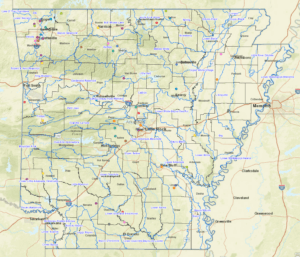
For more information contact:
Tate Wentz, Water Quality Section Manager
Arkansas Department of Agriculture
Natural Resources Division
10421 W. Markham Street
Little Rock, Arkansas 72205
Phone: (501) 682-3914 Fax: (501) 682-3991
Email: tate.wentz@agriculture.arkansas.gov